

| extra_vars1 | ||||||||||||||||||||||||||| |
|---|---|
| extra_vars2 | ||||||||||||checked||||||||||||||||||||||||||||||||||||||||||||||||||||||||||||||||||||||||||| |
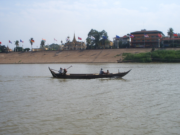
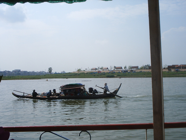
동남아시아 최대의 강. 중국 티베트고원 동부에서 남류하여 미얀마·라오스·타이·캄보디아를 경유하여 베트남 남부에서 남중국해로 흘러 들어간다. 메콩은 타이어계 호칭이며, 중국에서는 란창강[瀾滄江(난창강)]이라 부른다. 길이 4020㎞, 유역면적 80만㎢. 수원(水源)으로부터 라오스의 수도 비엔티안까지 상류부, 캄보디아의 수도 프놈펜까지 중류부, 그 이하가 하류부이다. 이 유역은 광대한 삼각주로 대미작지대(大米作地帶)이다. 메콩강은 상류로 올라갈수록 유역이 좁으며, 중국지역의 강수량이 적으므로 유량은 주로 라오스·타이·캄보디아·베트남의 강수량에 의해 좌우된다. 계절풍의 영향을 받아 우기와 건기의 차가 크며, 유량(流量)은 여름부터 가을에 증가한다. 메콩강 개발은 세계 각국의 기술·경제원조로 추진되고 있으며, 댐 건설 등을 중심으로 실시되고 있다
맨아래줄: 강가의로상아이스케키점. 때에따라선 동생은 1$구걸하기도하고 손미이있으면 합심으로 음료수도 팔고...하옇든 달라만 많이벌면 되니까.....
The Mekong River (known in Tibet as Dza-chu, China as Lancang Jiang and Thailand as Mae Nam Khong), is a major river in southeastern Asia. It is the longest river in the region. From its source in China's Qinghai Province near the border with Tibet, the Mekong flows generally southeast to the South China Sea, a distance of 4,200 km (2,610 mi). The Mekong crosses Yunnan Province, China, and forms the border between Myanmar (Burma) and Laos and most of the border between Laos and Thailand. It then flows across Cambodia and southern Vietnam into a rich delta before emptying into the South China Sea. In the upper course are steep descents and swift rapids, but the river is navigable south of Louangphrabang in Laos.
The natural resource management issues and priorities differ in each of the countries and the level of development and populations vary significantly. In north-east Thailand, with over 20 million people, the water resources are virtually fully developed and problems are emerging associated with salinisation of arable lands as result of over-clearing of native vegetation and poor irrigation, soil erosion, and declining water quality in the rivers and streams. In Laos, with 5 million people and a much poorer country from a GDP perspective, the water resources are largely undeveloped. Cambodia, with 10 million people, is recovering from decades of war, and in the Mekong delta some 20 million Vietnamese live on some of the most highly productive agricultural land in the world.
In short, the Thai want more water; the Laotions want capital and expertise to develop hydropower for export to Thailand and Vietnam; the Khmers need capital and infrastructure and to secure sustainable fishery resources in the Tonle Sap (Great Lake); and the Vietnamese, while in need of capital for the management of resources, do not want any upstream development to exacerbate salt water intrusion in the Mekong delta during the dry season.
Special feature - The Tônlé Sap
The Tônlé Sap is a shallow lake in western Cambodia which is part of the Mekong River system. It is the largest lake of Southeast Asia and is fed by numerous streams. During the dry season it drains by the Tônlé Sap River southeast to the Mekong River. During the wet monsoon season of June to November, the high waters of the Mekong River reverse the flow of the Tônlé Sab River and increase the size of the lake from 2,600 to 10,400 sq km (about 1,000 to 4,020 sq mi). When the high waters of the Mekong River recede, the flow reverses. This natural mechanism provides a unique and important balance to the Mekong River down stream of the lake and ensures a flow of fresh water during the dry season into the Mekong delta in Vietnam which buffers the intrusion of salt water from the South China Sea into the rich agricultural lands of the delta.
 |
 |
 |
| Normal Flow | Wet Season (Reverse flow into the Tônlé Sap) | Receding Flow During Dry Season |
Mekong River Fact sheet
Length
4,200 km (2,610 mi)
Countries
China, Myanmar (Burma), Thailand, Laos, Cambodia and Vietnam
Basin population
60 Million
Country population total
242 Million
Per Capita GDP
Varies from US$ 2,565 (Thailand) to US$ 265 (Cambodia)
Uses
Irrigation, fisheries, power generation, transportation, industrial and domestic supply
Primary Legal Agreement
Agreement on the Cooperation for the Sustainable Development of the Mekong River Basin, Chiang Rai, Thailand, 5 April 1995 - (Thailand, Laos, Cambodia and Vietnam)
Institutional arrangements
Mekong River Commission (Thailand, Laos, Cambodia and Vietnam)
Primary Legal Treaty / Agreement
The primary international legal agreement on the Mekong River is entitled "Agreement on the Cooperation for the Sustainable Development of the Mekong River Basin", which was signed in Chiang Rai, Thailand on 5 April 1995 between Thailand, Laos, Cambodia and Vietnam.
The primary Institution which has been established by the countries which are signatories to the Mekong Agreement is the Mekong River Commission (MRC). For notes on the MRC and how it functions, follow this link. Also see the Mekong Links Page for further information and a link to the MRC.
The Mekong system is extremely complex and effects the lives of some 60 million people, many of whom are amongst the poorest in the world. There are many demands made on the river - to provide water for industrial and agricultural development, to sustain subsistence fishing, for transport, to maintain delicate ecological and hydrological balances..... Inevitably there are conflicting demands made on the resource and very different views as to how the water should (or should not) be used. The riparian governments, working independently and together through such structures as the Mekong River Commission have a variety of plans for the development of the region, as do community groups, different stakeholders, local and international NGOs, private investment and construction interests etc. For greater detail of the various plans, views and perspectives, see the Mekong Links Page.
Background Information to the Countries of the Mekong Basin
|
Qinghai & Yunnan provinces, China |
Myanmar |
Thailand |
Laos |
Cambodia |
Vietnam | |
|
Area |
1,115,000 sq km (about 430,400 sq mi); |
676,552 sq km (261,218 sq mi). |
513,115 sq km |
236,800 sq km |
181,035 sq km |
331,690 sq km |
|
Average Annual Precipitation |
Tenasserim Coast 5,000 mm (200 in) Mandalay 760 mm (about 30 in) |
Bangkok 1,400 mm (56 in) Songkhla 2,540 mm (100 in) |
1,780 mm (about 70 in) |
1,400 mm (about 55 in) central plain 3,800 mm (150 in) in the mountains |
Hanoi 1,680 mm (66 in) Ho Chi Minh City 1,980 mm (78 in) | |
|
Population |
42,276,946 (1990 estimate) |
47,305,319 (1998 estimate) |
60,037,366 (1998 estimate) |
5,260,842 (1998 estimate) |
11,339,562 (1998 estimate) |
76,236,259 (1998 estimate) |
|
Population Density |
70 persons per sq km (181 per sq mi) |
117 persons per sq km (303 per sq mi) (1998 estimate) |
22 persons per sq km (58 per sq mi) |
63 persons per sq km (162 per sq mi) |
230 persons per sq km (595 per sq mi) (1998 estimate) | |
|
Urban/Rural Breakdown |
27% Urban 73% Rural (1997 estimate) |
21% Urban 79% Rural (1997 estimate) |
24% Urban 76% Rural (1997 estimate) |
20% Urban 80% Rural (Estimate) |
20% Urban 80% Rural (1997 estimate) | |
|
Gross Domestic Product |
US$41.4 billion (1997) |
US$153.9 billion (1997) |
US$1.8 billion (1997) |
US$3 billion (1997) |
US$24.8 billion (1997 estimate) | |
|
Per capita GDP |
US$ 875 |
US$ 2,565 |
US$ 342 |
US$ 265 |
댓글 0
| 번호 | 제목 | 글쓴이 | 조회 수 |
|---|---|---|---|
| 37 |
내기골프
| kimswed | 2668 |
| 36 |
압사라춤의진수
| kimswed | 3010 |
| 35 |
해외골프매너
| kimswed | 3482 |
| 34 |
캄보디아귀신
| kimswed | 3717 |
| 33 |
캄보디아불교현황
| kimswed | 6455 |
| 32 |
언니는미국/동생은한국
| kimswed | 2940 |
| 31 |
베트남에서캄보디아국경
| kimswed | 2403 |
| 30 |
크메르학살
| kimswed | 4900 |
| 29 |
캄퐁솜결혼
| kimswed | 2351 |
| 28 |
프놈펜8
| kimswed | 2945 |
| 27 |
phnompenh city
| kimswed | 3519 |
| 26 |
phnompenh central marker
| kimswed | 2239 |
| » |
메콩강기행
| kimswed | 4874 |
| 24 |
내고향-시아누크빌
| kimswed | 2539 |
| 23 |
아침식사<gundown>
| kimswed | 2296 |
| 22 |
캄보디아음식문화<gundown>
| kimswed | 2494 |
| 21 |
캄보디아야시장<gundown>
| kimswed | 1963 |
| 20 |
초대형물고기
| kimswed | 2498 |
| 19 |
라오스기행<kimjk10님의불로그:출처>
| kimswed | 1664 |
| 18 |
캄보디아정경
| kimswed | 1770 |
| 17 |
캄보디아여행기5
| kimswed | 2228 |
| 16 |
임신하면죽을대까지살아야
| kimswed | 2217 |
| 15 |
시골학교가이렇다
| kimswed | 2195 |
| 14 |
캄보디아/태국국경
| kimswed | 2098 |
| 13 |
앙코르사진전
| kimswed | 2178 |
| 12 |
여행후기56
| kimswed | 1568 |
| 11 |
아이들생활상
| kimswed | 1970 |
| 10 |
여성과어린이노동
| kimswed | 1579 |
| 9 |
전통춤
| kimswed | 2159 |
| 8 |
전통풍습
| kimswed | 2798 |